

The project represents an Intrusion Related/IOCG Gold-Copper exploration opportunity in a new metal frontier, with numerous geochemical and geophysical targets established along structural corridors extending over 200 km².
The Amazon Craton is a highly prospective crustal block known for its significant endowment in gold, copper, tin, manganese and iron.
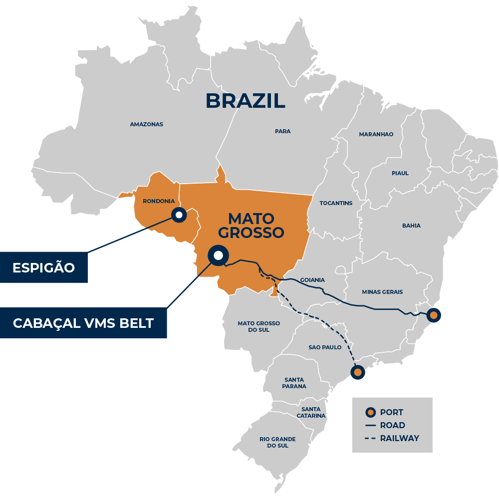
The Espigão Project is located on the southwest margin of the Amazon Craton, in the western margin of the Proterozoic Rondônia-Juruena Province. The basement geology in the project area is dominated by a series of fractionated granitoids. An extensive network of mineralised structures extends over 200 km² in the core of the licence area, and comprises base metal anomalous manganese veins, ferruginous breccias and tin-bearing greisen. The Company is focused on testing the copper-gold potential of the licence area.
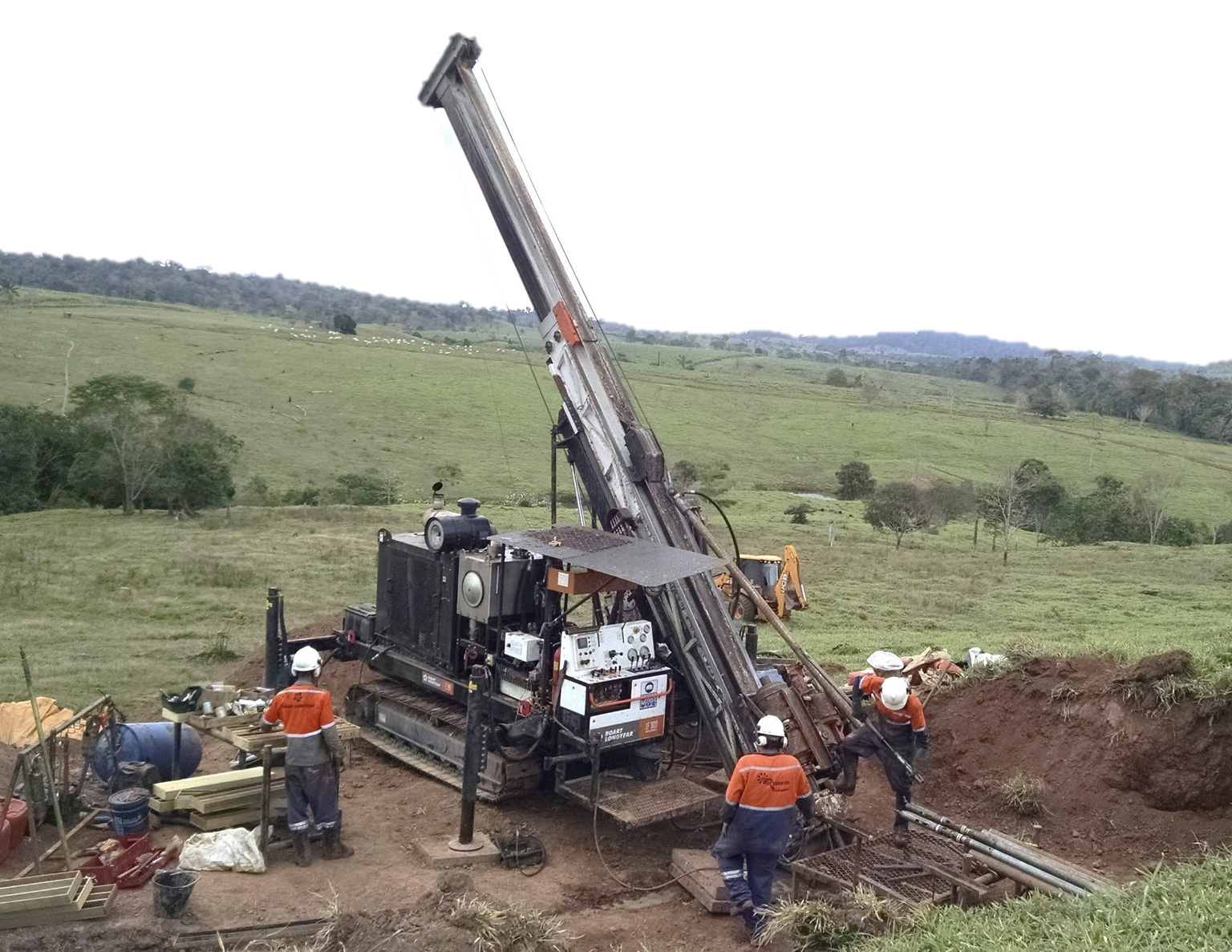
Meridian has obtained permission from the state environmental agency (SEDAM) to carry out its drilling programme at Espigão and has commenced field evaluation to plan logistics and access/ a first phase of reconnaissance drilling is planned to test the project’s copper-gold potential during 2026.
Between 2007 – 2019, more than 200,000t of manganese oxide concentrates were produced. They hosted elevated copper grades (an average of > 0.2% Cu to a peak of 0.8% Cu), and variable concentrations of other base metals (in places to percent levels). The chemical variations are consistent with partitioning processing in a large-scale hydrothermal system. Potential exploration analogues include Kitumba-type IOCG system, or intrusive system (several examples of which have a history of high-grade manganese production from Cu-anomalous vein systems).
Some plant and infrastructure related to the manganese processing remains on the project, and tenure includes exploration licences, one approved mining licence, and several mining licence applications.
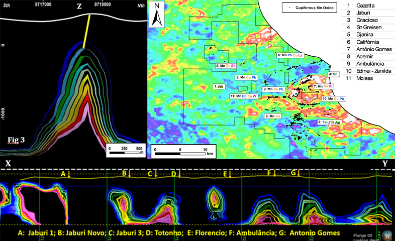
Espigão Metal Corridors on Total Count Radiometrics
Click image to enlarge
District scale zonation: Copper and Gold +/- Lead +/- Zinc +/- Tin anomalies have been mapped across the licences.
Espigão Geophysical Targeting
Click image to enlarge
Electromagnetic (EM) conductive plates are positioned above the magnetic anomalies and below the surface mineralisation.
The modern exploration strategy is to leverage off a database of past exploration which has tested the vein systems at shallow levels (average depth of past drilling 40m below surface; depth of weathering extends to typically ~20-30m depth). A HeliTEM survey has been completed over much of the area. Modelled Maxwell plates will be further evaluated as potential targets for deeper drilling.
The existing stream and soil sampling databases will be progressively extended with systematic multi-element surveys along all corridors. Complementary geophysical surveys will be considered for deep targeting, including gravity, and electrical geophysical methods.